- Query by Location
- Measuring Tools
- Report a Problem
- Find a Place
- Layers
- WMS or WMTS overlay
- Overlay the pictures in my computer
- Switch Base Map
-
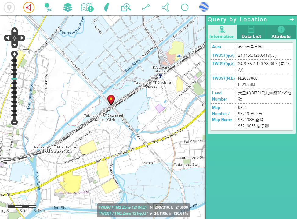
Click
 and move the pointer to the map. Left click at the inquiry position, the result will be displayed at the right side of the window.
 -
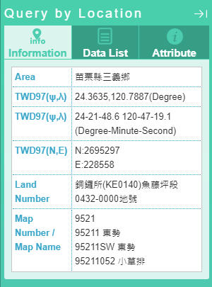
(1)Information of the Point Positon: Display the administraive district, coordinate value, pracellary, and map sheet of the point position.
-
(2)Map List: Clisk the map type and the map item of the point position will be displayed.
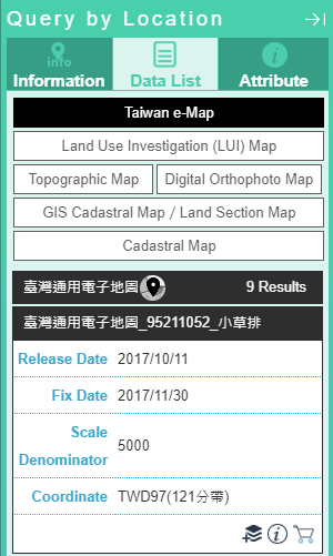
:Overlap the map on the page after clicking.
:The metadata of the map will be displayed after clicking.
:The thumbnail of the map will be disaplayed after clicking.
:The map can be added to cart after clicking.
(This function will be displayed only after log in.)
-
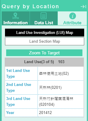
(3)Attributes: choose the map type, and the attributes of the point position will be displayed.
-
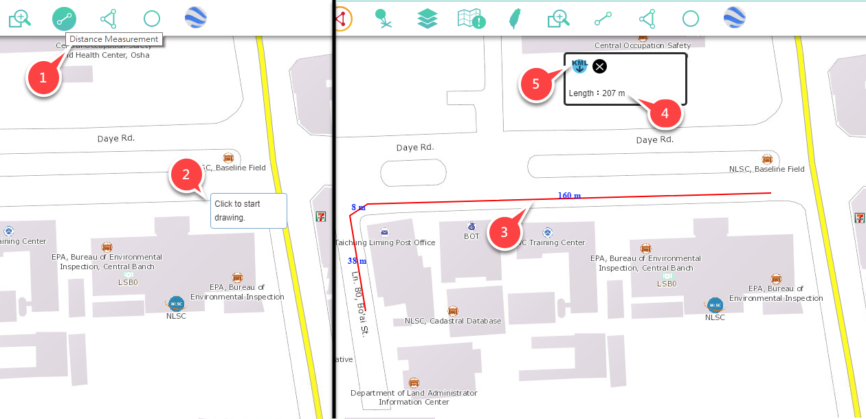
This function provides the polyline and measures the length of it.
-
(1)Click on
 "Distance Measurement."
 -
(2)Move the pointer to the measurement position of the map, and click to start drawing.
-
(3)Keep clicking on the measurement position of the map. When finish drawing, double click on the same position.
-
(4)The screen will display the length information of line segment.
-
(5)Click on"Download KML," and export the map to KML file.
-
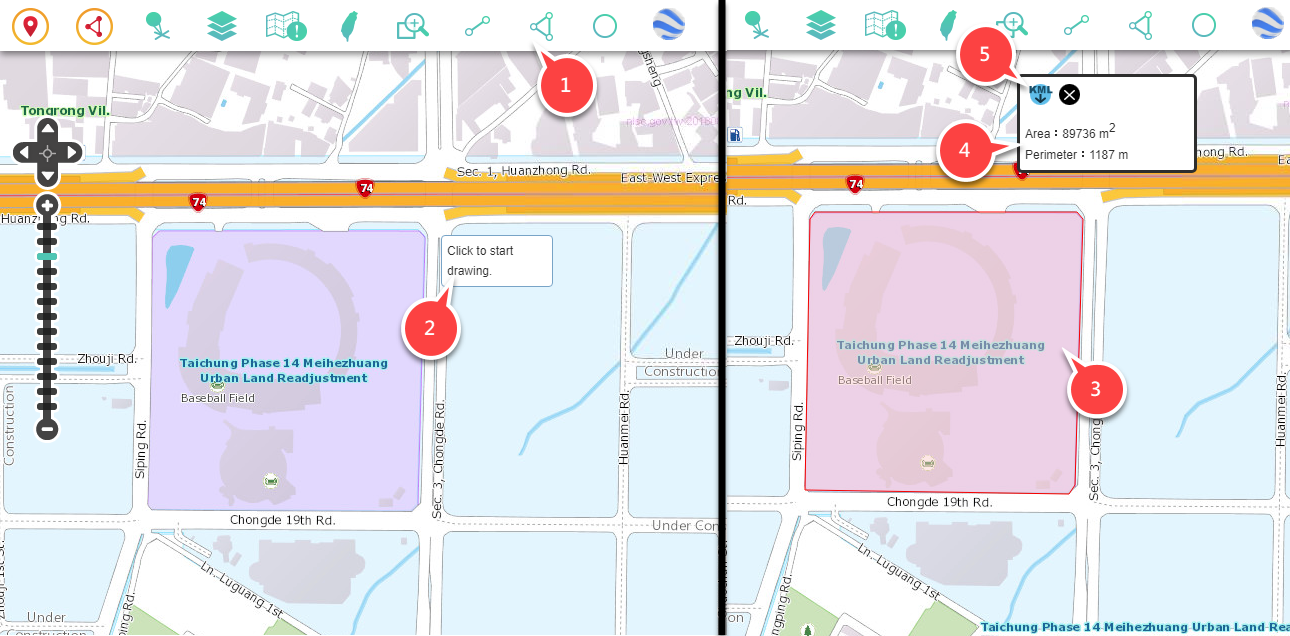
In this function, you can draw a polygon and measure the area and perimeter of the polygon.
-
(1)Click on
 "Area Measurement."
 -
(2)Move the pointer to measurement position.
-
(3)Keep clicking on the measurement position of the map. When finish drawing, double click on the same position.
-
(4)The screen will display the area and length of the polygon.
-
(5)Click on "Download KML," and export the map to KML file.
-
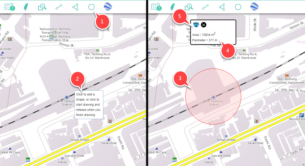
In this function, you can draw a circle and measure the area and circumference of the circle.
-
(1)Click on
 "Buffer Measurement."
 -
(2)Move the pointer to the measurement position of the map and left click on it (this is the center), and keep click on it and do not drop.
-
(3)Move the pointer to appropriate distance, and drop the pointer to finish drawing. (The distance between press the left button and release the button is a circular radius.)
-
(4)The screen will display the area and length of the polygon.
-
(5)Click on"Download KML," and export the map to KML file.
-
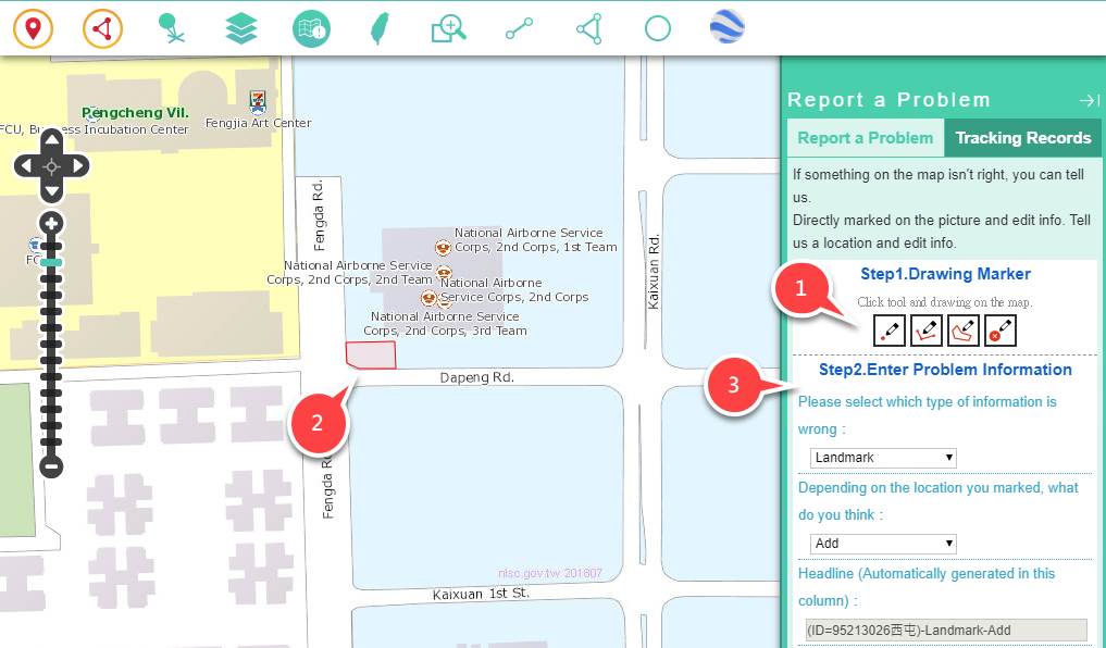
Provide the notification channel to report faults which will be included in the future maintenance and be revised as soon as possible.
-
If you find any mistakes, please click
 "Map Reporting," and use the following 2 ways to report mistakes:
 -
1st: Fill in reporting sheet and send it back. "Download Reporting Sheet" (Detailed information is included.)
-
2nd: Mark the mistakes, and write down the information:
(1)Click on map mark tool.
(2)Draw on the maps.
(3)Fill in data and click on "Yes."
-
-
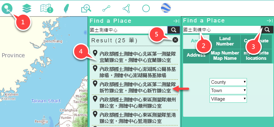
(1)Click on
 "Quick Positioning."
 -
(2)Enter keywords.
-
(3)Click on"Search."
-
(4)Click on positioning items in results.
-
(5)Close the window after search.
-
-
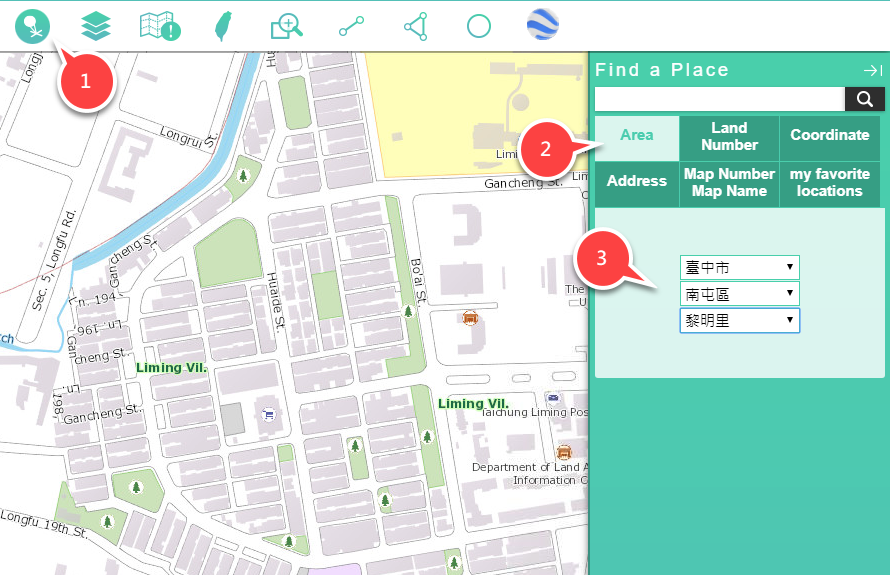
(1)Click on
 "Quick Positioning."
 -
(2)Click on the positioning of "Administrative District."
-
(3)Choose County (City), Township or Village.
-
(4)The map will be automatically located in the selected county, town or village.
-
-
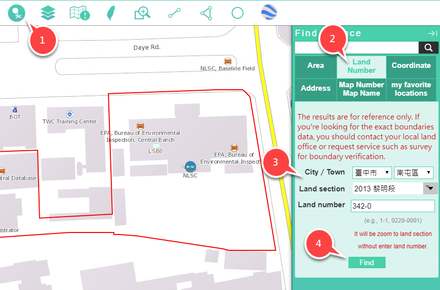
(1)Click on
 "Quick Positioning."
 -
(2)Click on the positioning function of "Pracellary and Parcel Number."
-
(3)Choose County (City), Township or Village.
-
(4)The map will be automatically located in the selected pracellary and parcel number.
Note 1: choosing townships and villages is a require.
Note 2: pracellary can be filtered by keywords.
Note 3: Parcel number is an optional item. If no parcel number is entered, pracellary will be used in positioning. -
-
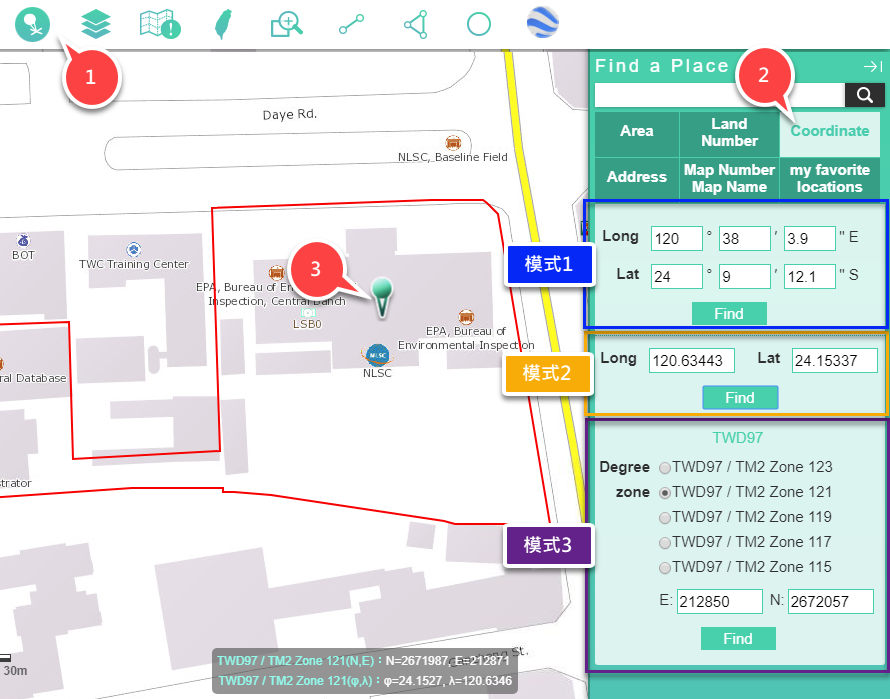
(1)Click on
 "Quick Positioning."
 -
(2)Click on the positioning function of "Coordinate," and 3 modes will be displayed:
●Mode 1: Enter the minute and second coordinate of east longitude and north latitude, and click on "Position."
●Mode 2: Enter the coodinates of east longitude and north latitude, and click on "Position."
●Mode 3: Choose zoning and enter coordinates, and click on "Position."Note: When positioning is performed, the coordinate values for performing positioning are automatically written to other modes, and can also be used as a tool for coordinate conversion (this coordinate conversion value is only for reference)
-
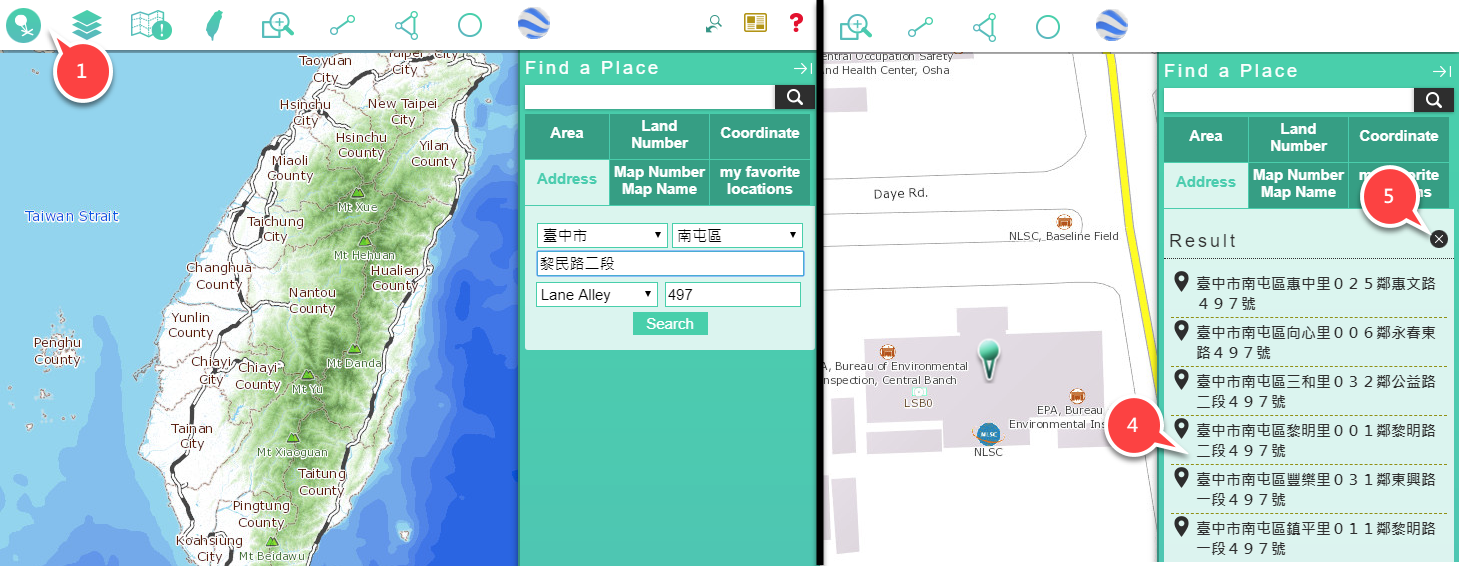
-
(1)Click on
 "Quick Positioning."
 -
(2)Click the positioning function of "Building Number."
-
(3)Choose County (City) and Township, enter the keywords of the name of road, enter lane, alley, and number.
-
(4)Click on positioning items in results.
-
(5)Close the window after search.
-
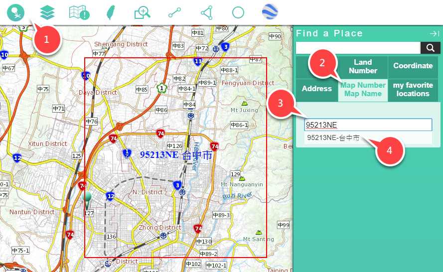
-
(1)Click on
 "Quick Positioning."
 -
(2)Click on the positioning function of "Number and Name of the Map."
-
(3)Enter the keywords of Map Number or Map Name.
-
(4)Choose a positioning item in results.
-
-
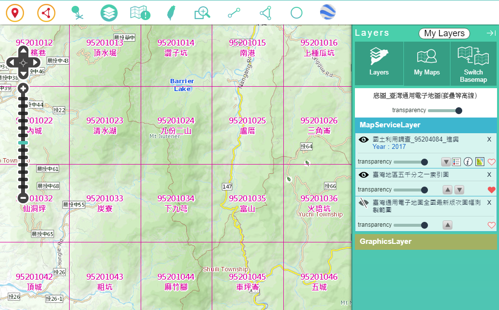
Click on
 "List of the Layer," overlayed maps will be displayed. And settings are as follows:
:The layer will be hided on the map after clicking.
:The layer will be displayed on the map after clicking.
:The layer will be removed on the map after clicking.
:Move the dot to change the transparency of the layer.
:The description of the layer will be displayed after clicking.
:The metadata will be displayed after clicking.
:The thumbnail will be displayed after clicking.
:The pattern can be set after clicking.
-
Provide WMS or WMTS overlay.
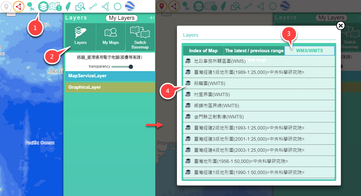
-
(1)Click on
 "List of the Layer."
 -
(2)Click on "Layers can be overlayed of Taiwan."
-
(3)Choose classification.
● Index map: providing scale map sheet in Taiwan. (WMS)
● Latest range of map sheet: The map of measurement range will be applied in Land Use Investigation, Taiwan E-map, and Basic Topographic Map.
● WMA: WMS or WMTS will be provided to the Center or other institutions. -
(4)Choose maps.
-
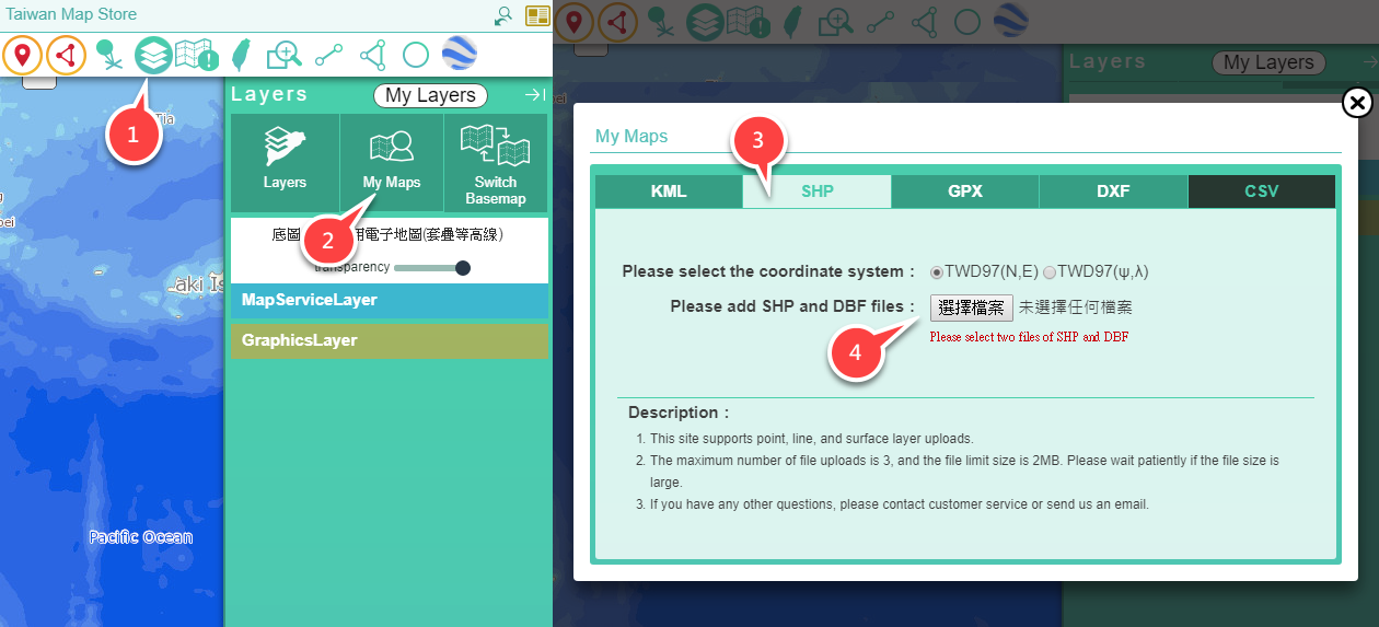
Provide the image files in the overlay user's computer.
-
(1)Click on
 the "List of the Layer."
 -
(2)Click on "My Maps."
-
(3)Choose the image format you want to overlay.
-
(4)Choose coordinate system and file.
-
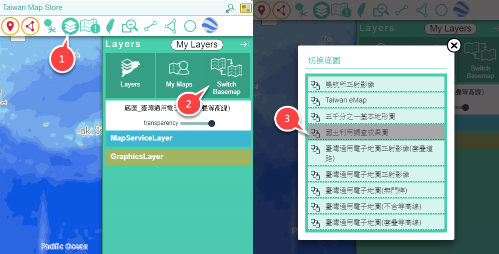
Provide a base map for change.
-
(1)Click on the "List of the Layer."
-
(2)Choose "Change base map."
-
(3)Choose maps.